Course Outline
Module 1: Introduction to GIS
Module 2: Introduction to ArcGIS pro
Module 3: Exploring Spatial Relationships – includes joins/merges/intersects
Module 4: Creating and Editing Data
Module 5: Symbology in ArcGIS Pro
Module 6: Exploring Map Layouts
Module 7: Analysis of multiple different types of datasets from different sources
Module 8: Overview/ understand of different types of geospatial files
Module 9: ArcGIS Pro basics: finding your way around the new interface
Module 10: Using the ribbon and tool bars to find the right tool
Module 11: Displaying data in ArcGIS Pro: Add data and updating layer symbology
Module 12: Data Management: Creating your own projects and data for use in ArcGIS Pro
Module 13: Editing tools: Using the Edit ribbon to add, remove and modify your features in ArcGIS Pro
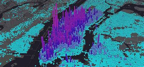
Module 14: Understanding 3D: Accessing the 3D options within ArcGIS Pro to view and explore layers in a 3D environment.